The Seven Years War

The Seven Years War, also known as the French and Indian War, began in the 1750s with borderlands skirmishes between French and British forces and their respective Native American allies. By 1759, it had spiraled to become a global contest for empire. Fighting as proud royal subjects, British colonists rejoiced at France’s defeat in 1763. (At the College of New Jersey, for instance, students staged a musical titled “The Military Glory of Great Britain.”) But the war was wildly expensive, and it set the stage for a political crisis between the deeply indebted British government and colonists who would now be asked to shoulder more of the costs of empire.

A New and Accurate Map of the English Empire in North America: Representing their Rightful Claim as Confirmed by Charters, and the Formal Surrender of their Indian Friends, 1755
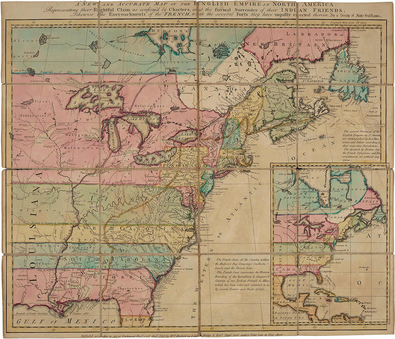
Society of Anti-Galicans
Engraved by R. Bennett. London: Sold by Wm. Herbert & Robt. Sayer
Bequest of William H. Scheide, Class of 1936
With colonial boundaries stretching absurdly toward the Pacific, this map illustrates not the reality of British settlement (which still hugged the Atlantic coast in 1755) but rather plans for future expansion. Such territorial ambitions sparked the war with France, whose “encroachments” are indicated here. Native American territories are also recorded in great detail, as Britain’s vast claims to dominion rested on alliances with some Native polities (such as the Six Nations) and cessions forced from others.

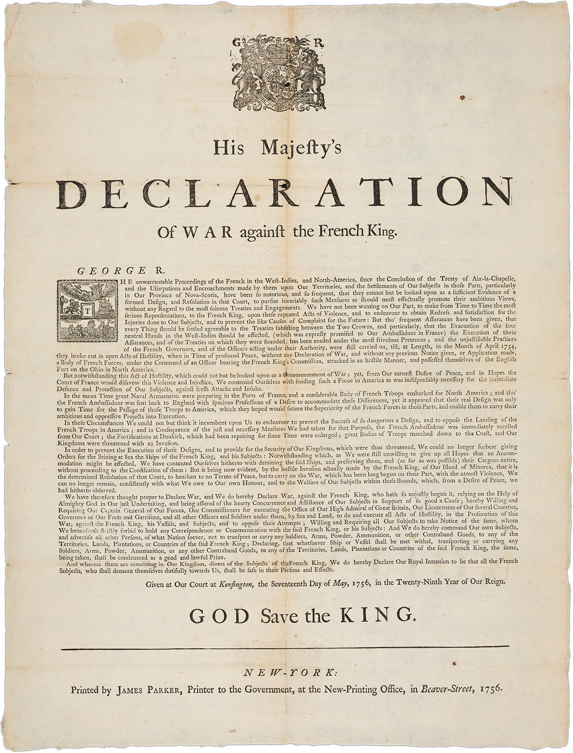
His Majesty’s Declaration of War Against the French King, 1756
New-York: Printed by James Parker
Bequest of William H. Scheide, Class of 1936
Fighting had been underway in North America for nearly two years before the 1756 outbreak of hostilities in Europe itself forced King George II to officially declare war against France. This broadside, printed in New York, spread the news throughout the colonies. The Crown relied heavily on colonial contributions of soldiers and supplies, leading colonists to expect a share of the fruits of victory after they helped expel France from North America in 1763.
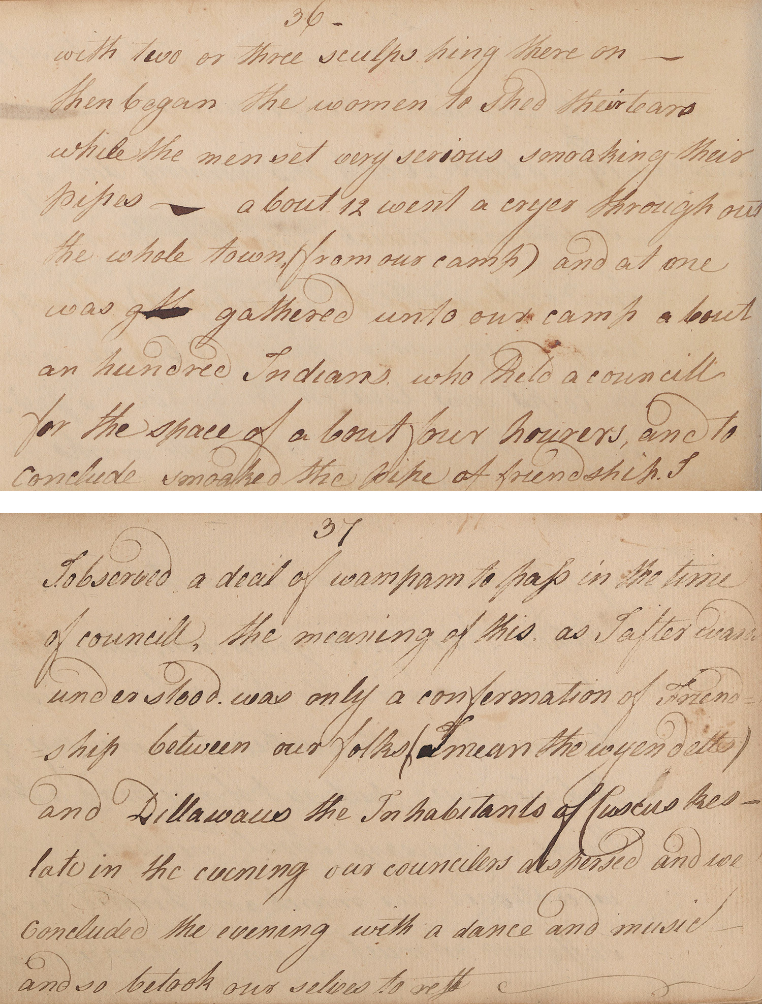
 Diary of a captivity among the Wyandots, 1758-1759
Thomas Gist (died 1786)
Gift of P. Blair Lee and E. Brooke Lee
In 1758, Thomas Gist was an ensign in the Virginia militia under young George Washington’s command. Captured by French-allied Wyandots during a failed attack on Fort Duquesne (at present-day Pittsburgh), he was brought to a village near Detroit and ritually adopted into a Wyandot family. This journal of his 12-month captivity details Wyandot customs, family life, warfare, and politics—including, as seen here, a diplomatic council with allied Lenapes in the village of Kuskuski—before his eventual escape

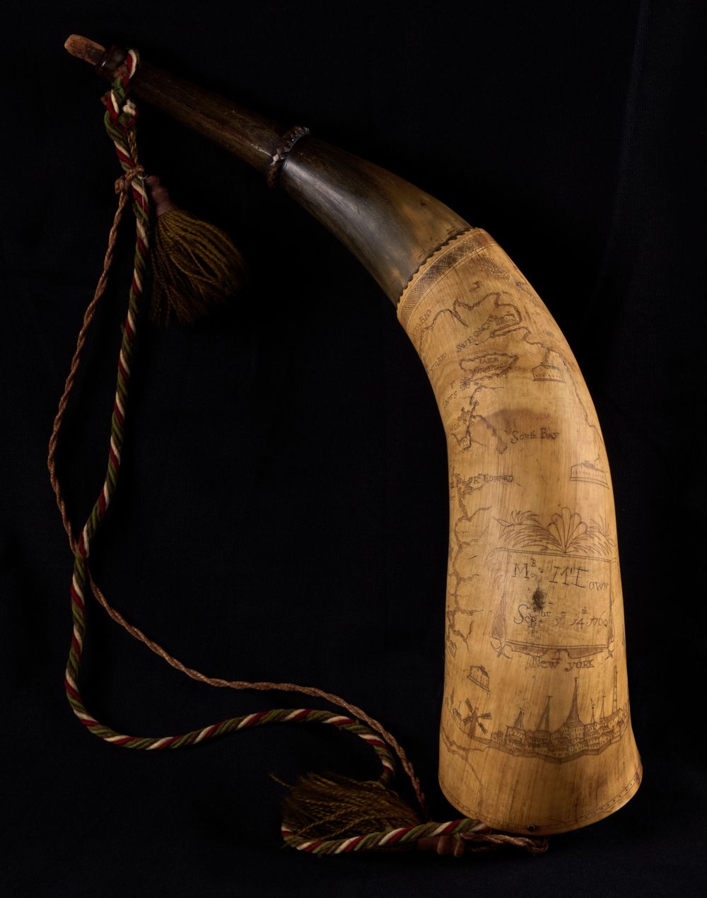
Powder horn, engraved with a map of the route from New York to Canada
Inscribed by Mr. McEown, September 14, 1760
Gift in memory of Lars G. de Lagerberg
Though vital for urgently loading gunpowder into muskets when bracing for battle, powder horns also gained personal resonance during 18th-century campaigns. During idle moments, soldiers often personalized their horns by engraving them with routes taken, battles won, or favorite patriotic cries. McEown—an otherwise unidentified soldier—engraved his name on this horn in 1760 and etched a map of the theater of war in the northern borderlands between New York and Quebec.
Use the 3D viewer to explore the object. Click and drag to rotate, and scroll or pinch to zoom in for a closer look.