Maps & Plans
GIOVANNI BATTISTA NOLLI (1701–1756), CARLO NOLLI (1720–AFTER 1770), GIOVANNI BATTISTA PIRANESI (1720–1778)
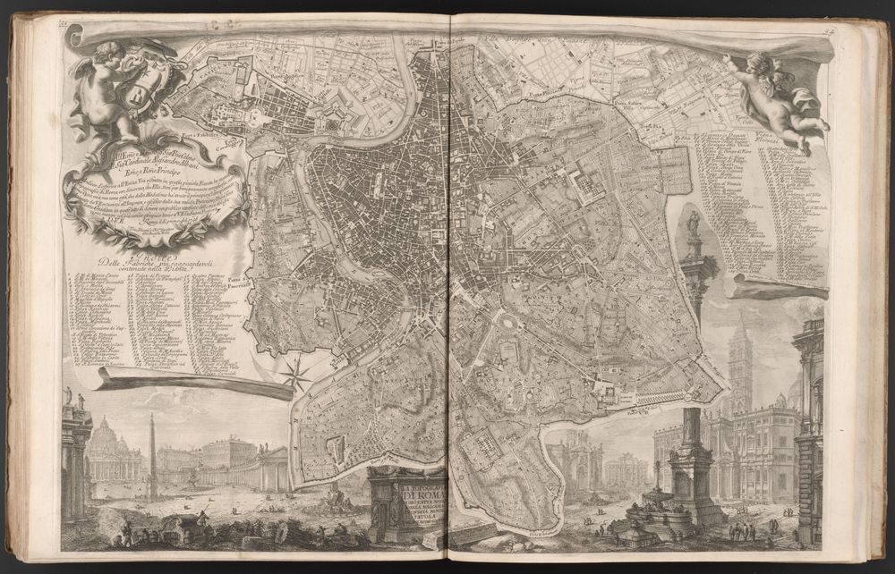
Topografia di Roma di Gio. Batt[ist]a Nolli dalla maggiore in questa minor tavola dal medesimo ridotta. Rome, 1748
Rare Books, Department of Special Collections, Princeton University Library
Mapmaking was one of Piranesi’s first activities as an artist. When he first came to Rome, Piranesi helped Nolli make an enormous map of Rome, published in 1748. Together with Nolli’s son Carlo, Piranesi etched this small map, a miniature version of the bigger one. It was sold together with the sheets of the larger plan, as in this bound volume. The small city views at the bottom of the map, the putti at the top, and the cartouche and lists of monuments at the sides are some of Piranesi’s earliest printed work. The views of ancient and modern Roman monuments include the Trevi Fountain, Bernini’s Four Rivers Fountain, and the Column of Trajan.
GIOVANNI BATTISTA PIRANESI (1720–1778)
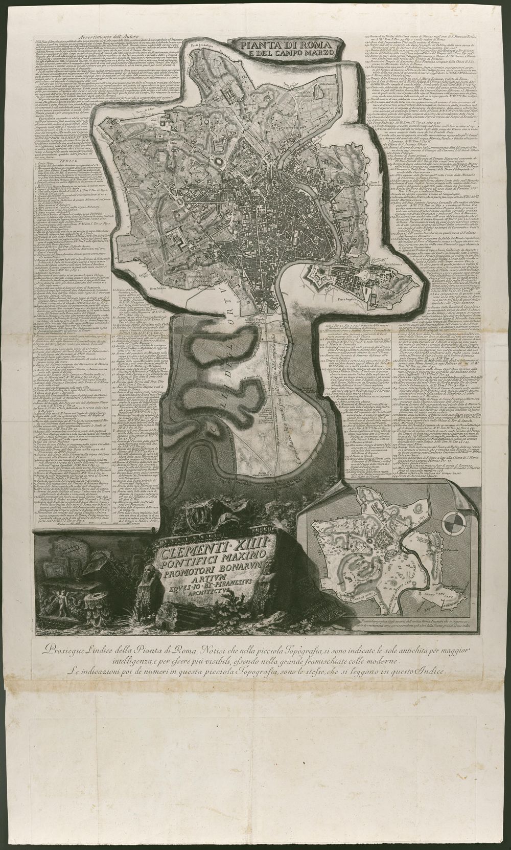
Pianta di Roma e del Campo Marzio. Rome, c. 1774
Rare Books, Department of Special Collections, Princeton University Library
Piranesi’s earlier works echo in this one. Late in Piranesi’s career, after he had already published large-scale maps within the Antichità Romane and the Campo Marzio, Piranesi returned to the subjects of these books with this city plan. He expanded the small version of Nolli’s map that he had helped etch in 1748 and reversed its north-south orientation. Like the plan of the Campo Marzio, this map appears to be etched on a stone fragment. The columns of text combine a staggering amount of information onto one large page, printed from multiple copperplates and assembled from several pieces of paper. Although the enormous map seems designed for a wall, it also was planned with books in mind. The print could be used as a spectacular frontispiece or accompaniment to copies of the Vedute di Roma, one that doubled as a table of contents for the prints and reference point for its depicted monuments.
GIOVANNI BATTISTA PIRANESI (1720–1778)
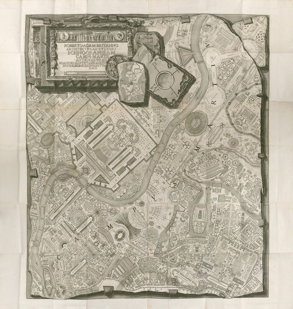
Ichnographia, Campo Marzio dell’antica Roma. Rome, 1762
Marquand Library of Art and Archaeology, Princeton University Library
One of Piranesi’s most famous prints, the Ichnographia is a map of the Campo Marzio, the ancient district used as a military training ground. Printed from six plates, today the map is most often found framed on walls. Yet Piranesi published it as part of a large volume of other prints showing views of structures found there. Latin and Italian texts discuss Piranesi’s explorations of the surviving ruins, analyses of classical sources, and discussions of numismatic and other forms of historical evidence. Most notably, Piranesi used fragments from the Forma Urbis Romae, the third-century map of Rome carved on stone, to reconstruct parts of the city plan. Piranesi displays his own map as if it, too, has been carved in stone, and mounted to a wall with metal clamps. The map is also part fantasy: Piranesi designed as much of the ancient city as he reconstructed from evidence.
GIOVANNI BATTISTA PIRANESI (1720–1778)
Scenographia, Campo Marzio dell’antica Roma. Rome, 1762
Rare Books, Department of Special Collections, Princeton University Library
* New Acquisition
The Scenographia, a print from the Campo Marzio volume, is a view of the area that Piranesi reconstructed in his spectacular fold-out map, the Ichnographia. In the scene of the ancient field of Mars, the Tiber River winds past a few buildings set into the landscape. A tableau of inscribed stone fragments in the foreground references the historical materials that Piranesi used in his topographical research, including both texts and ruins. To the left and right, indexes connect the depicted monuments to other prints and textual discussions in the book.
GIOVANNI BATTISTA PIRANESI (1720–1778)
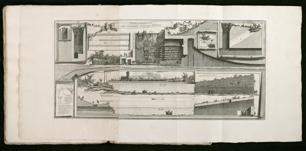
Dimostrazioni dell’Emissario del Lago Albano in Descrizione e disegno dell’Emissario del Lago Albano, tav. III. Rome, 1762
Rare Books, Department of Special Collections, Princeton University Library
Piranesi’s interests in aqueducts, hydraulics, and ancient Roman engineering converge in this giant fold-out plate. This book describes the tunnel that the Romans constructed to drain Lake Albano. Piranesi combines plans, sections, and details of the massive underground waterway into one image, illustrating different aspects of the tunnel as if rendered on separate sheets of paper. He was particularly interested in the vertical openings that connect the tunnel’s subterranean passage to the surface, alternating between above- and below-ground scenes. He exploits the illusion of the layered page to suggest how the form of the book--itself an assembly of multiple pages--can convey spatial complexity.


